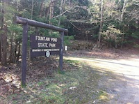
Fountain
Pond State Park Start at
Berkshire South Regional Community
Center parking lot. There?s a
kiosk and trailhead toward the
treeline that leads up a series of
stone steps. The first pine forest
hides a ropes course owned and
operated by Berkshire South
Regional Community Center?be sure
to ask permission before using any
of their equipment.
The first bit is the most
difficult, climbing around 300
feet of dominant undergrowth such
as vines and shrubs. It levels out
into rocky outcroppings and small
wetlands, the forest types varying
in tow with the invasive species.
Boardwalks and bridges make the
occasional patches of mud or
wetland a nonissue and you can
find several species of mushroom
and wildflower from the relative
comfort of elevated walking. A
double-bough bridge marks the
halfway point. From there enjoy
the relatively flat path through
tall hardwoods and occasional
eastern hemlock forest.
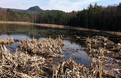
Wandering to the end of the trail
is greatly rewarding. The views of
Fountain Pond are terrific, even
from Route 7, but to actually
enter the woods and see it as it
once was, devoid of the human
impact, that is, save the trail,
is nothing short of inspiring.
Great for birding, wildlife
viewing, and even picnicking, if
the trail from Berkshire South is
too long (about 2 miles) then use
the trailhead along route seven to
skip to the best part.
If you?d care to go on a group
hike then check out Berkshire
Natural Resources Council?s
website (www.bnrc.net)
or their
event calendar. Similarly
check out www.gbtrails.org
and/or www.gbtrails.org/events1.html
 Directions: From
the center of Great Barrington
head north on Route 7, take a
right onto Crissey Rd, and drive
to the end for parking at
Berkshire South Regional Community
Center. The fountain pond
trailhead is about a half a mile
north on Route 7.
Printable
version of the Pfeiffer
page
If you have any trail updates to
share or have feedback/questions
please send
email.
|