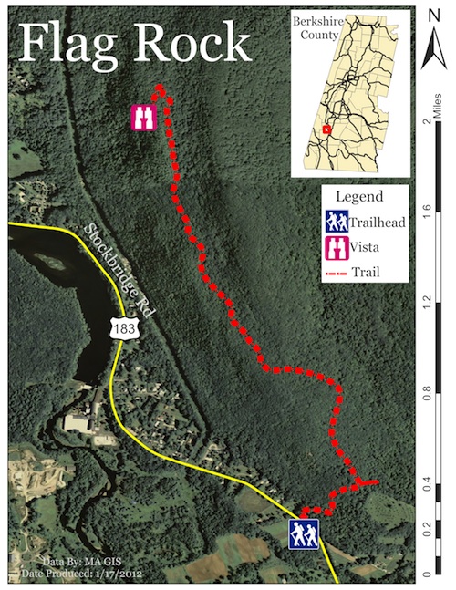
Flag Rock
is a short but rewarding
experience. With easy to moderate
terrain it shouldn?t pose too
serious of a
challenge?nevertheless the (on
average) two hour hike will race
the hearts of even the most
experienced trailblazer.Located
just outside of downtown
Housatonic and close to Taft?s
Farm it?s considered the ?back
side? of Monument Mountain.
The trailhead isn?t well marked
and situated within a thicket of
trees just off the road. Look for
well-worn Subaru tracks, cliff bar
wrappers, and/or hitchhiking
woodsmen if you?re turned around.
There is a small field across from
it, owned by Taft Farms, and they
tend to grow pumpkins and
butternut squash in it, although
it changes per season per year.
Once you hit the path get ready
for a ride. Climb a humbling
hillside before turning (make sure
you don?t wander into Root
Orchard) onto a straight flat
section filled with old oaks and
maples. Continue until you meet a
fork, going straight will send you
to Monument?s Summit, turning left
and up an immediate hill toward
Flag Rock.
After the short hill it levels out
and continues along a flat and
straight section. Look for square
and rectangular depressions
several yards off of the path.
They?re the remnants of old
technologies?percolation pits,
charcoal pits, some even claim
they were used to produce
gunpowder during Shay?s Rebellion.
The trail bends right (north),
ventures down a steady slope and
begins a slow climb. Continue
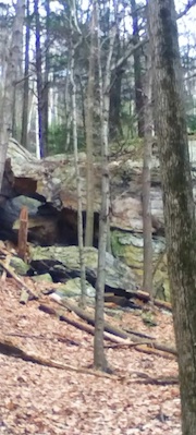
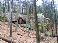
onward and you?ll come upon two of
the more distinctive pieces of the
reservation. The higher bits
follow a short valley accentuated
by ancient trees and massive rock
formations.
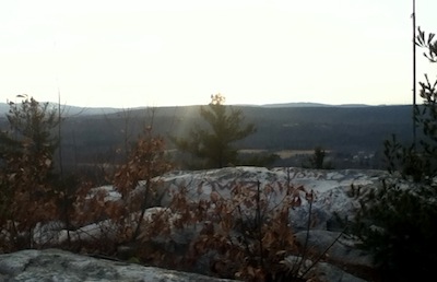
Finally it turns up the final
portion marked by a cairn, a small
rock pyramid, and the forest
thins, turkey buzzards swoop
overhead, and the sights and
sounds of Housatonic come into
view. From the scenic vista you?ll
see Alford, the Taconics, and on
especially clear days, the
Catskills.
Click
here if you're interested in
getting a guided hike in this
region.
 Directions:
From South: Take RT-7 N to RT-183 N,
trailhead is 0.2 miles past Taft
Farms on the right. From North: Take
RT-7 S to RT-183 S, trailhead is 0.3
miles past Rising Paper Mill.
Directions:
From South: Take RT-7 N to RT-183 N,
trailhead is 0.2 miles past Taft
Farms on the right. From North: Take
RT-7 S to RT-183 S, trailhead is 0.3
miles past Rising Paper Mill.
If you have any trail updates to
share or have feedback/questions
please click
here to send email. |