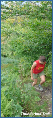
Thunderbolt Trail is the shortest and consequently steepest route up or down Mt. Greylock - Massachusetts highest peak at 3,491 feet. It climbs the eastern side of the mountain, starting in the town of Adams from the Greylock Glen. The Thunderbolt Trail was originally a CCC built ski trail, and in 1936 hosted the United States Eastern Alpine Ski Championships. Its current course has been somewhat altered from the original, but is no less challenging. The Thunderbolt Foot Trail climbs gently west winding through the forest south of Hoxie Brook, and eventually the foot trail will intersect the old ski trail on your right. At about the half mile mark, the trail becomes considerably steeper and heads northwesterly towards the summit ridge. This stretch is quite broad and is recognizable as a steep, tree-lined ski run. At about the 1.5 mile mark the trail reaches the summit ridge, where you have a beautiful view upon the town of Adams from Hadley Lookout. The rocky outcroppings on the ridge line to your left (as you face downhill from Hadley's lookout) are Ragged Mountain, and Raven's Rocks (An awesome place to see Greylock on another day!) From the Hadley Lookout the trail levels considerably and bears southwest to the summit along a short stretch of the Appalachian Trail. This last stretch is approximately half a mile and during winter, affords a fine view of the monument on the summit when conditions permit. The trail passes a small stone shelter, and the summit road on the way to the top. The total vertical via this route is approximately 2,275 feet in about two miles. You should allow for 1-2 hours to summit via the
Thunderbolt, and half that time to descend. In winter, add another hour to ascend. But if you just wanted the views and scenery without a challenging hike, you can drive up the mountain via the main road. Visit the Mt. Greylock for more information.
In winter, snow conditions are typically varied from under a foot at the base, to over five feet in sheltered areas on the summit ridge. Most of the snow may also be blown from the immediate vicinity of the highpoint. Personally, I would discourage winter hiking on the Thunderbolt
without modern snowshoes, trekking/ski poles and/or an ice axe for
self-arrest. It isn't Mount Everest, but people should be aware of
sound winter travel principles any time they attempt steep terrain in
frozen conditions. (DO NOT attempt this hike unless you have experience with winter hiking techniques.)
(Skiers note: If you're looking for a challenge or if you're into some of the best back country skiing in all of New England you'll find it all on the Thunderbolt. The pitch is similar to what you may find on a black diamond trail at a modern resort, the trees and natural obstacles make this a more challenging run than at first it may appear. Typically, those interested in skiing the trail
should wait until a bit later in winter for the base to form, and
start hiking in the dark if they have any hopes of beating the locals
to first tracks on a powder day! Also, a great resource
for more Backcountry skiing is the New England Lost Ski Area Project:
www.nelsap.org)
Thunderbolt is listed on the Mt. Greylock State park trail map,
and is open year-round for hiking, snowshoeing and skiing. You are
welcome to hike it in the winter even if you do not intend to ski it,
but the considerate thing to do is stay in the path of those who have
already ascended in order to preserve snow quality. Many skiers summit
Mt. Greylock via the bellows pipe trail and descend via the Thunderbolt
since the Bellows Pipe is a less difficult climb and occasionally
packed by snowmobiles. There's also a great movie about the history of the Thunderbolt called
"Purple Mountain Majesty" created a few years back by some locals, and
the living relatives of Thunderbolt legends.
(The trail description and photographs on this page are courtesy of Ryan Auge').
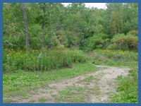 Directions: : The trailhead can be reached by traveling south on Highway 8 from the town of North Adams. On the northern side of the town of Adams, bear right onto Friend Street, follow this Friend Street (which will become West Road), and then approximately 1.5 miles will be Thiel Road. Turn right onto Thiel Rd., pass through the Jaeschke's Apple orchards and into the Geylock Glen. Thiel Road continues straight past the intersection with Gould Rd. and you can park at the end to access the Thunderbolt Trailhead.
Printable version of the Thunderbolt Trail page
If you have any trail updates to share or have feedback/questions please click here to send email or call 203.788.7665
|