(Use this page to print out the hike. Click the back button to go back to the webpage - www.berkshirehiking.com)
South Taconic Trail is a north/south 12-mile gem of a trail skirting along Massachusetts and New York state borders in the region where Connecticut, Massachusetts, and New York meet. The northern end of the trail begins off Route 23 just up the road from the Hillsdale, New York, Catamount Ski Area. About the middle of the trail sits Mount Washington State Forest way up high on the eastern side of the mountain range South Taconic blazes through. Adjacent to that, just over the other side and down in a western valley is the popular tourist spot Bash Bish Falls which is home to Massachusetts' biggest waterfall. It's this middle section that sees the most visitors along the 12 mile trail since the southern ending point of South Taconic Trail is literally a tiny patch of dirt across the street from a house in very typical suburban neighborhood - it's an odd ending/beginning for such a great trail - and the northern starting point just doesn't seem to be on folks radar. Crowning off the middle section of trail, and bridging the state forest and waterfall area, is Mount Alander. The views from Alander are magnificent in all directions. You'll see very far on a crystal clear day. Nearby Mountains of Mount Frissell (the highest point in the state of Connecticut lies on the southern side of Frissell whose peak is in Massachusetts), Brace Mountain, and South Brace Mountains add some more crowning jewels dotted around near by each other. Overall, South Taconic doesn't see that many hikers and portions of the trail are rarely used. That's good news for you since South Taconic Trail might be the best least-known-trail in a 100 mile radius.
Some of the long distant views along the trail are absolutely stunning with a gorgeous waterfall (Bash Bish Falls) and wonderful highlands rounding it all off. Wild flowers blossom throughout the spring, and summer brings a white and pink Mountain Laurel extravaganza exploding mid/late June. Fall foliage is a Perfect 10 and winter hiking is bitter cold like only a high ridge-line can be, but also beautiful in a way only winter can be. In all runs through a region The Nature Conservancy has designated "one of the last great places". This place feels more like 1750, or pre-European settlement, than early 21st century. It's remote without actually being remote. It can feel more like Irish highlands or Maine backwoods more so than a spot just three hours from Manhattan and an hour away from mall suburbia.
It can be hiked full in one day if a car can be parked on both ends. To do all if it would require excellent physical conditioning and lots of trail experience (or if you happen to be in world class hiking shape then you probably could tackle a 24 mile back and forth trip with thousands of feet of total elevation gain which would allow one car access!). But it's mostly a place where day hikers venture in from side trails rather than tackling the whole thing. South Taconic isn't a trail with back-country camping but there is a back-country camp site within Mount Washington State Forest that's just about a mile away from South Taconic Trail. You can also camp at Bash Bish Falls State Park or nearby Taconic State Park and use those rustic settings to venture off up into the hills. But there are no camp sites along South Taconic Trail.
Nearly all hikers, however, will want to choose from a variety of short side trails that hook up into South Taconic Trail to enjoy a brief or medium sized foray into a region that is truly unique. You probably won't see them, but black bear, lynx, bobcat, rattlesnake, and ...mountain lion? (uh oh, big debate ensues!!..probably not but some locals are adamant they've seen them). It gives you an idea of what a special ecosystem it is. You can get lost back there if you're not familiar with the entire trail systems. South Taconic runs straight up and down but does intersect with several side trails leading off into remote forest. Locals have blazed some of their own trail and old logging roads are easily spotted. It's a wild place for what it is and South Taconic Trail has some "good goons" protecting it from suburban sprawl. Mt. Riga Reservation to the southeast in Salisbury, Connecticut, Mt Washington State Forest to the east, and New York's Taconic State Park to the west, and Bash Bish State Park to the north. It sits up on a plateau almost like a table with rolling hills, with a massive watershed falling off each side into valleys below. If you visit Mt. Washington State Forest website you can download a basic map to use as trail reference for this entire region. It includes almost the entire South Taconic Trail. http://www.mass.gov/dcr/parks/western/mwas.htm. Other maps are listed below.
Each side trail leading in to South Taconic Trail has their own unique beauty but all of them are wonderful starting points. Some folks enter in via Bash Bish Falls while others choose Mt. Washington State Forest. (You can also try another direct route to Alander by clicking on the "Mount Alander" link near the top of this web page after reading this trail description. This trail leads up to Alander's peak from Undermountain Road in New York and meets up with South Taconic Trail at Alander's peak.)
Getting to Alander can be done several ways. One option is to start off at Bash Bish Falls and hike a tough 3.4 mile trail to Alander's peak. Bash Bish is the tallest waterfall in Massachusetts and when rains are gushing it's a spectacular sight. It sees a lot of visitors especially summer weekends and fall foliage weekends but 90% of the people only visit the falls and don't hike up beyond them. Most weekdays even during heavy family camping season aren't too bad in terms of crowds so even summer weekends you should be able to use Bash Bish as a jumping off point for South Taconic Trail. It's postcard perfect all year round (early spring, fall, or winter are the best times since a hot dry summer is when the falls is at its least). Bash Bish to Alander is steep and through a cool, dark hardwood forest for the most part until it nears the clearing of Alander's peak. As you rise up to the plateau the rest of the world is left behind you. You emerge into something else...and it's a great something else. It's just really nice up there and the more you hike the more views open up. Alander peaks out at 2,250 feet with unbelievable views in all directions and it stands right about at the half way point for the South Taconic Trail. If you get one of those crystal clear days you won't want to come down. Alander, with it's vast grassy plateau and rocky outcrops, almost feels like "the couch" of The Berkshires. It makes you want to lie back and take in the cinematic experience...and you may just doze off into a nice comfy nap before heading back.
But, oh... keep an eye on the rattlesnakes when trying to find a spot to lunch or get away from other hikers if it's a fairly busy weekend day. Stay on the trail and don't venture off singing "the hills are alive with the sound of music!" with arms wide and strides galloping. Eastern Diamondback's hate Julie Andrews...no just kidding...they hate being stepped on. They're not usually on the trail...rarely in fact...but they are up in that region. Stay on the trail and you'll be fine. Don't go off blazing your own trails. You could step on a rattlesnake. They might bite you if you did. That would hurt. Maybe even worse. If you stay with the trails there's no worry at all because they are so incredibly shy and wary of people (hunters). Alander sees lots of hikers and no reports of bites in recent memory. But if you're the type that likes to venture off and explore off trail...don't. Just kick back and enjoy the beauty of this unique mountaintop. You've been warned...each anti-venom shot will cost $1,000...and it might take as many as 10 to get you right. Alander is in my top 5 spots for hiking in Massachusetts and Connecticut. I go there often and have NEVER seen a rattlesnake. But they are there for sure - just not hanging out with hikers up on the peak.
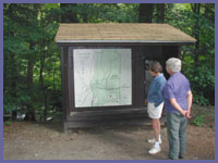
At the northern section of S.T.T. (South Taconic Trail), not far from Bash Bish Falls, is Sunset Rock. Probably popular with locals since it's a short hike from a dirt road (West Street) that you would cross if you were hiking the S.T.T north/south, this spot offers a wonderful western view of the valley below and the Catskill Mountains way off in the distance. It's a photographer's dream with a perfect vantage point for sunsets. You can drive up to a trail head that leads to Sunset Rock if you just wanted the view and not a hard hike. West Street is a short distance off Route 341 which brings you close to Taconic State Park. Ask the park ranger if you can't find West Street on your own. It's not a safe road at all during a heavy rain or in winter when it may in fact be closed. Even in dry times it's a bit hairy in one small section so use good judgement. You can also hike up to Sunset Rock from Bash Bish Falls. Just check the trail map in the parking lot and head north following the trail directions.
At the southern end of S.T.T., Brace and South Brace Mountains, near twins at 2311 and 2304 feet, offer up wonderful views as if looking down over an Irish countryside. It's Columbia County New York and these western views are gorgeous. They go a bit unnoticed but a fair amount of hikers do pass over them so the trails are fine. Brace is a spot where you shouldn't be shocked to stumble across a paraglider backpacking in to launch him/herself into the thermals that rise over the valley below. What a ride they must have though what a tough hike to launch that flight!
South Taconic Trail starting options:
Northern Trailhead. Technically there is one, but locally there are two. Most people start out at Bash Bish Falls and up to Alander which is about a 3.4 mile hike one way. However, the trail actually starts several miles north right off of Route 23, just up the road from Catamount Ski Resort. Some local folks don't even realize the official start of S.T.T. isn't Bash Bish. Route 23 to Sunset Rock trail portion sees the least amount of hikers since some may consider it boring. It's not, but it's certainly not as spectacular as starting from Bash Bish Falls which can be crowded at its base on summer or foliage weekends but never crowded high up in the mountain. From Route 23 south to Sunset Rock is about 2 miles, mostly uphill. From Sunset Rock to Bash Bish is about another mile, maybe more if you wanted to hike all the way down to the falls' base area. From the top of Bash Bish Falls to Alander is about 2 miles. The Bash Bish-Alander portion of the trail is steep up out of the falls then a steady climb to the peak. Whether you do the Route 23 or Bash Bish start, this northern portion of S.T.T. to Alander is a hiker's dream. But not at all for beginners or those just bringing a bottled water and a snack. Lunch is a must and so it 2 liters of water!
Mid Trail. Mt. Washington State Forest headquarters offers a wonderful hiking experience from its base over to Alander Mountain. From there you could choose to hike a bit of S.T.T. north or south before heading back. Just be careful when heading out from Mount Washington's parking lot not to take Ashley Hill or Charcoal Pit trails off of the Alander Mountain Trail since they both take you way away from Alander Mountain and south towards the tri state marker where CT/MA/NY meet. There are some first-come-first-served backpacking campsite on Ashley Hill Trail so if you were thinking of heading out in this region for a few days you could camp down here. It's about a 4-5 round trip hike, less if you keep a quick pace and in very good hiking shape. Another option to just hike up to Alander a bit is via Undermountain Road trailhead. Click here for description and directions. A third option, that would be a definite workout but quite doable with lots of sun light, patience, and lots of water/food to power you along, could be to hike in from the Mt. Frissel dirt parking lot high up on East Street and a few miles south of Mount Washington State Reservation parking lot (in winter and very early spring the dirt road can become beyond muddy to down right impassable to all except 4 wheel drive and is closed during winter in). Click here for details and driving directions - a long hike but you'd get to visit Connecticut's high point (on the side of Frissel's southern slope), then the tri-state cement border almost 100 years old, then onto the STT and north (right) to Alander Mountain. This option also offers a loop option by hiking east out of Alander Mountain along Alander Mountain Trail back towards Mt. Washington State Park. You could follow Alander Trail all the way back to Washington's headquarters then walk the few miles back to your car along the nice rural road that eventually turns gravel. Or you could hang a right well before headquarters onto Ashley Hill Trail (or if you missed that Charcaol Pit Trail a short distance later) and hike back to Frissel trail and east back to your car going back over Frissel. This would be an all day marathon hike but it's about as good a hike in this region as one could do.
Southern Trailhead. This is trailhead is more remote than the others since it's a little tricky to find because it just sits across the street from a house in a residential neighborhood. And the hike from here is not easy. It is...for about 5 minutes...then trail then hits it hard and steep passed a sometimes flowing waterfall, along a ridge, then up and up to both South Brace and Brace peaks. Then you have to decide if you've got the water, food, and energy to press on to Alander which is still a good long distance away. This trail is not recommended for those new to this part of the trail and/or if you're in just so-so shape. In summer this hike usually is one of those hot ones where only briefly will the forest cover you from blazing sun. In this area, this is a 5 on a scale of 5. It may not be the Rocky Mountains but it's a tough hike for most people and would give a workout to even those in outstanding physical condition. Many hikers under rate this portion of trail. It's not bad if you just wanted to huff and puff up to the first overlook and perhaps on a little more from there to South Brace or Brace Mountains. But be well prepared (physically and with supplies) if you tackle it all the way to Alander. You're in officially fantastic shape if you make it there and back without too much trouble. If you want to try this section of the trail, get on Route 22 going north/south in New York. Watch for Whitehouse Crossing. Take Whitehouse Crossing through some farms until it ends at Boston Corner Road. Take a left on to Boston Corner Road, then a very short distance up the road will be Deer Run Road. Take a right on to Deer Run which is a dead end road but just before it ends take a left on to Quarry Hill Road. You'll go up and then bend down to the right along Quarry Hill Road. As it flattens out a bit look to your left and you'll see a sign for South Taconic Trail and Taconic State Park. It's across the street from a house and just a barely visible dirt/grass parking area.
YOU DEFINITELY SHOULD NOT HIKE INTO SOUTH TACONIC TRAIL WITHOUT A MAP. Don't under estimate your ability to get confused at certain trail intersections if you're not familiar with the South Taconic Trail.
South Taconic Trail Map - a great map and the best looking one out there. Nice and big and easy to read. Created by a group that really did extensive research to create this map and produced a beautiful map. Become a member for just $25 and get 3 maps - Mount Greylock, Yokun Ridge, and South Taconic Trail. Or you can get the South Taconic map for $8. http://www.bnrc.net Click on STORE to buy map.
New York/New Jersey Trail Conference South Taconic Trails Map - most avid hikers consider this the best map for South Taconic Trail. http://nynjtc.org Click on STORE to find maps and it's called South Taconic Trails. $4.95 for non-members.
If you buy a copy of AMC Massachusetts and Rhode Island Trail Guide the back of the small paperback has a map of several areas. One of the areas is South Taconic region. It's a great map except it's too light on the print it almost seems faded or you need a magnifying glass to look at elevations or certain key trail intersection. The northern few miles where trail starts at Route 23 are cut off so you can't see where exactly the northern most point begins. But it's one that is easily folded up and used so don't let that comment keep you from buying it because it includes a good deal of hiking trails in that general area including the parallel Appalachian Trail which is really nice to have in one map. Most bookstores should have it along with online bookstores like Borders or Barnes and Noble. If you buy used book MAKE SURE IT STILL COMES WITH MAP.
Snakes? Well, probably not but it is worth noting that the highland regions on either side of the trail are ideal Eastern Timber Rattlesnake country. These snakes want nothing to do with people and don't ever venture far from the dens where they were born. Very secretive and not exactly teeming in numbers like an Arizona dessert. Unfortunately for the snakes, they've been hunted and poached to only a few hundred. It is HIGHLY unlikely you'll see one let alone have a worrisome encounter. (Sadly, one man, has hunted an estimated 4,000 snakes in his life and seems to take glee in that he knows he's going to prison IF they can prove he's hunted one...which they never have. He literally is a wanted man in many eastern states.) But if you turn out to be the rare hiker to see a rattler and you're worried, just stop and give the snake plenty of time/room to get away from you which is what it will be desperate to do. If by some insane odds you become one of the first hikers bit by a rattler in recent memory (you'd literally have to step on one for that to happen), call 911 if you have a cell phone and are alone. With or without a companion, proceed very slowly back since blood rushing faster through the body spreads venom quicker. If you are with several people it would be best if they could carry the bite victim out or perhaps going for help so emergency workers can carry them out. It won't kill you but if you didn't get to the hospital within a few hours you could be in for a terrible experience. If you ignored it completely and didn't go to the hospital at all, well...that could be a problem greater than just a horrible inconvenience. Statistically speaking, you have to be a young male, drunk, (sorry my Southern friends...I'm just going by statistics) Southern, and hunting or teasing snakes to be a likely snake bite victim. They do not advance on people nor can they strike farther away than their body length. So if you're 7 feet away from one that looks to be about 5 feet you've got no worries...unless you decide to try and walk over it. Once in a blue moon someone living in the area is jumped at or bitten if they are gardening in their yard and not thinking "this is rattlesnake country" as they reach down to weed or prune right where a rattler is resting. Unlike some of their cousins in other parts of the country, it's not clear why these snakes are so docile to the point where they may not even rattle if you had an encounter or move even if you touched one (DON'T TRY THAT!!). These might be the only rattlers that won't bite you if you stepped on them...though don't test that theory! Some researchers feel it's because the more dominant ones who rattle and warn were completely hunted out of existence leaving the shy/quiet ones to propagate the species in the region. This is noted here as an obligation to warn you but it shouldn't in any way keep you from hiking here since you're more likely to see a bear than a snake...oh sorry...the bear's sleep all day and roam at night so don't worry about them either because you're not going to see one! Just be aware of things and stay on the trail and all will be well.
Directions: For easy access to the trail use the trail entrances via Mount Washington State Forest (http://www.mass.gov/dcr/parks/western/mwas.htm) or Bash Bish Falls (). If you're the type that just likes to find all trail heads then the northern extreme of the trail is off Route 23 up the road from Catamount Ski Area. The southern extreme entrance via Quarry Hill Road is described above.
© Berkshire Hiking 2006