(Use this page to print out the hike. Click the back button to go back to the webpage - www.berkshirehiking.com)
Beartown State Forest in Monterey, Massachusetts is nestled in a beautiful forest gem in the southern Berkshire Mountains. The 12,000 acre forest seems to have a little bit of everything for the outdoor enthusiast and those who simply want to relax outside. Monterey is just about halfway between downtown Great Barrington and the town of Otis along Route 23. It's not in the middle of nowhere but it definitely is quite rural and offers a great "away from it all spot". Western Massachusetts is truly underrated in terms of geological beauty and Beartown State Forest proves that point. Many people from New York City or Boston area who visit Western Massachusetts for the first time are surprised at how mountainous, rugged, rural, beautiful the region is. Beartown is right in the heart of the hardwood forest section of southern Berkshires and it's obvious why logging used to be a huge industry (and still remains in some small spots). This place has some trees!
If you intend to hike, it's important to note that the state forest is very different in terms of recreation in winter than summer. Summer means hiking, swimming, paddling, and with some mountain biking available. Winter means snowshoe, cross country ski, snowmobiles, and hunting. Winter hiking near Benedict Pond (Lake Benedict) and along the Appalachian Trail is a good choice but be aware that if the park gets snow, hikers share other parts of the state forest with non-hikers. In summer the beach area receives plenty of visitors but the park as a whole is a hiker's dream. Fall is magical when the leaves change and Spring is refreshing as only Spring can be. Miles and miles of trails to choose from that go far back into fantastic hardwood forests. If you bring a compass you can almost just keep it pointed north and follow some of the trails way back and disappear for hours. The more north you go, the more remote it is. Or staying close to the parking lot you can venture off on easy or moderate hikes. You've got some nice choices here. A couple of scenic views to ramble up not far from the main parking lot, an Appalachian Trail section with some lean-to's for back country camping, and a gorgeous Benedict Pond 1.5 mile trail loop. Though no trail summits Beartown Mountain (3,247 feet) or Mount Wilcox (2,755 feet), there are a couple of nice overlooks on other mountain spots that are no more than a mile in from the main parking lot. Beartown is very hilly with some wetlands dotted here and there throughout the state forest. We're talking timbered mountains...and lots of timber (hardwoods and pines)! With streams, brooks, smaller ponds, pools of water, it's easy to see how bobcat, lynx, beaver, fischer, deer, and of course black bear (thus the name Beartown) can make a decent living in this spot. When you hike back into the northern section of the forest it might remind you of Maine or northern Vermont/New Hampshire. If you get lucky, you may be part of the rare few who see bobcat or bear. It's a lush green forest from floor to canopy. If you're into botany or birding, you'll have a field day here.
A good choice for those looking to hike Beartown for the first time is to trek along Benedict Pond Loop Trail. It's great for all ages and abilities and would be a great choice if you were introducing kids to hiking. It's an easy, flat, 1.5 mile trail circling Lake Benedict which really is just a big pond. The map says Lake Benedict but the spot is called Benedict Pond. hmmm? Either way, it's a beautiful hike in a spot Thoreau, Emerson, Dickinson, or Monet would have loved and appreciated endlessly. On the far side away from the main beach area it's really serene and peaceful nearly any time of year but week days during school year bring the best chance of blissful solitude. Lake Benedict and the lush forest that surrounds it make for almost guaranteed spirit refreshment. Most of the year it won't see many hikers at all. But this being the modern world, there is a small beach/camping section that Homer Simpson would appreciate! So, keep in mind that in summer, especially weekends, the beach area sees a fair amount of family day visits and weekend camping. That shouldn't keep you from hiking the Benedict Pond loop even that time of year but you will have to hike past a short section of family style camping at the start or finish of your hike. Hey, sometimes a modern restroom with showers, snack bar, pay phone, are just what a hiker needs so I'm not knocking it at all! Picnic tables are dotted around too so have one before or after your hike. And perhaps toss a bathing suit in your back as the water is cool and refreshing and the beach area allows for plenty of swimming.
The Applachian Trail runs through Beartown for a couple of miles. It's on the southwestern side of the park running more or less north/south, on the eastern face of Mount Wilcox. At the far end of the Benedict Pond Loop Trail, the Appalachian Trail meets up with it so just note that for a short section the white blazed trail of Appalachian Trail is the Loop Trail. There's a cool footbridge at the Benedict Pond Loop Trail and Appalachian Trail intersection. If you're looking for a moderate hike and the fairly easy Loop Trail around the lake won't be enough for you, follow the A.T. north a bit up and away from the Benedict Pond Loop Trail. About a half mile will be a scenic overview looking out south to the last of Berkshire Mountains. It's a really nice spot. Continue on the A.T. a bit if you want to check out the back country lean-to system for camping in the forest. One lean-to is about a mile beyond the scenic overview and the second one is about 3 miles beyond the overview. The A.T. does allow you to explore a bit beyond Benedict Pond so it's an option in addition to the nice loop.
If you choose to just do the Benedict Pond loop, the trail at times can be rocky and filled with tree stumps. A few sections can be wet and other spots rise up a bit over the pond and may cause you to venture out to look over. Stay with the trail to prevent trail erosion but also to prevent slipping and falling. Benedict Pond has a bench or two made out of the very trees that make the place magestic so use those to enjoy the pond view.
If you're a hard core hiker you can disappear all day or even a few days if you wanted to camp out and hike all the trails in the state forest. There are dozens of miles of trail to choose from. The best thing to do is visit the official website for Beartown State Forest and print out one of their nice maps. Be sure to choose "summer" or "winter" map depending upon the time of year you're there. Spring/summer/fall you can safely really on the "summer map". If you hike in winter be aware that hunters are allowed in especially into the back country and some roadways allow snowmobiles if there's a few inches of compacted snow.
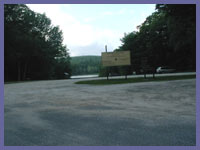
The ranger's station is a couple miles southeast of the beach/campground and main hiking parking lot. If you intend to use the state forest for other activities than hiking you should check in at the ranger's station that is just down the road from the Route 23 state forest entrance. Plenty of places that have maps but the ranger's station is a good choice to get a guaranteed one and perhaps check in for any trail updates or potential warnings such as recent bear sightings, etc.
Just taking a ride to Beartown State Forest is beautiful. Stepping out and venturing in a bit, or a lot, is one decision you should wind up feeling happy about. Visit, http://www.mass.gov/dcr/parks/western/bear.htm, to gather official in depth information and contact info.
 Directions: Beartown State Forest is right off Route 23 in Monterey, MA about halfway between downtown Great Barrington and the town of Otis. For directions it's best to refer to http://www.mass.gov/dcr/parks/western/bear.htm and follow their driving suggestions to get into the state forest. You can also use "69 Blue Hill Road, Monterey, MA 01245" if you like to use online mapping sites such as Mapquest, Yahoo, Google.
back to Beartown State Forest page
© Berkshire Hiking 2006